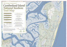
Thanks to the hard work of the Georgia Conservancy, there's a new trail map to
Cumberland Island National Seashore, complete with trail descriptions.
Recently, the Georgia Conservancy along with more than 450 volunteers worked on restoring hiking trails on the island off the Georgia coast. They spent more than 6,300 volunteer hours restoring, signing, and mapping the island's 50 miles of trails as part of REI's Every Trail Connects campaign. Part of their effort was to meticulously map all trails, roadways, and features on the island to produce a much-needed trail map.
This map gives you over 22 trails to hike, run, or bike. It tells you a description of each trail as well as its distance.


